
Geotechnical Exploration
|
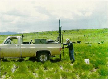
| A USBR geotechnical engineer collecting a soil sample.
(Image Source: Wikipedia) |
Before any construction or design work can be completed at a potential dam site, conducting geotechnical subsurface and onsite material exploration is essential. These explorations consist of both invasive and non-invasive sampling methods. Invasive geotechnical sampling methods may include drilling boreholes and taking core samples from the overburden and bedrock within the footprint of the dam and its appurtenances, taking soil samples from open pits, or using correlative field tests. Non-invasive geotechnical sampling methods may include but are not limited to using geophysical methods involving emitting ground penetrating radar or creating mechanically induced seismic waves.
The intent of the geotechnical investigation is to characterize the foundation conditions and uncover any potential problems at the project location. Any potential problems that are identified by thorough investigation can be addressed in the design of the various features of the dam.
“The magnitude of the foundation exploration program is governed principally by the complexity of the foundation problem and the size of the project. Explorations of borrow and excavation areas should be undertaken early in the investigational program so that quantities and properties of soils and rock available for embankment construction can be determined before detailed studies of embankment sections are made”.[1]
“Investigate site geologic and geotechnical conditions in a manner that adequately examines embankments, spillways, abutments, borrow areas, and foundations to enable adequate evaluation of all design conditions. Provide appropriate intensity and detail of these investigations for the class of dam, complexity of site geology, and the data needed for the dam design”.[2]
Types of Destructive Exploration
The methods below are common techniques used for destructive exploration:
Types of Non-Destructive Exploration
"Remote sensing is defined as the act of gathering data concerning the earth's surface without coming into contact with it. Remote sensing is performed using devices such as cameras, thermal radiometers, multispectral scanners, and microwave (radar) detectors. Engineering and geologic interpretation of remotely sensed data may be simple or complicated, depending on the nature of the data and the objective of the study. Remote sensing is a tool which makes some tasks easier, which enables some tasks to be performed that could not otherwise be accomplished, but which may be inappropriate for other tasks. Depending on the situation, remote sensing may be extremely valuable or totally inappropriate. Some remote sensing interpretations can be used directly and with confidence; but for most applications, field correlations are essential to establish reliability. Appropriate specialists should be consulted when evaluating situations to determine if remote sensing methods can provide useful data."[3]
The methods below are common techniques used for non-destructive exploration:
Best Practices Resources
![]() Technical Release 210-60: Earth Dams and Reservoirs, NRCS
Technical Release 210-60: Earth Dams and Reservoirs, NRCS
![]() Drilling and Invasive Activities at Dams and Levees (ER 1110-1-1807), USACE
Drilling and Invasive Activities at Dams and Levees (ER 1110-1-1807), USACE
![]() National Engineering Handbook: Chapter 2 - Engineering Geologic Investigations, NRCS
National Engineering Handbook: Chapter 2 - Engineering Geologic Investigations, NRCS
![]() National Engineering Handbook: Chapter 3 - Engineering Classification of Earth Materials, NRCS
National Engineering Handbook: Chapter 3 - Engineering Classification of Earth Materials, NRCS
![]() National Engineering Handbook: Chapter 4 - Engineering Classification of Rock Materials, NRCS
National Engineering Handbook: Chapter 4 - Engineering Classification of Rock Materials, NRCS
![]() National Engineering Handbook: Chapter 5 - Engineering Geology Logging, Sampling, and Testing, NRCS
National Engineering Handbook: Chapter 5 - Engineering Geology Logging, Sampling, and Testing, NRCS
![]() General Design and Construction Considerations for Earth and Rock-Fill Dams (EM 1110-2-2300), USACE
General Design and Construction Considerations for Earth and Rock-Fill Dams (EM 1110-2-2300), USACE
![]() Geophysical Exploration for Engineering and Environmental Investigations (EM 1110-1-1802), USACE
Geophysical Exploration for Engineering and Environmental Investigations (EM 1110-1-1802), USACE
Trainings
![]() On-Demand Webinar: Drilling Plans and Hazard Evaluations for Dams and Levees
On-Demand Webinar: Drilling Plans and Hazard Evaluations for Dams and Levees
![]() On-Demand Webinar: The Practical Use of Geophysics to Assess Dam and Levee Safety
On-Demand Webinar: The Practical Use of Geophysics to Assess Dam and Levee Safety
![]() On-Demand Webinar: Field Investigations for New and Existing Dams
On-Demand Webinar: Field Investigations for New and Existing Dams
Citations:
Revision ID: 7271
Revision Date: 07/18/2023